
SDG COUNTIES, Ontario - The Raisin Region Conservation Authority (RRCA) is issuing a Water Safety Statement for its jurisdiction.
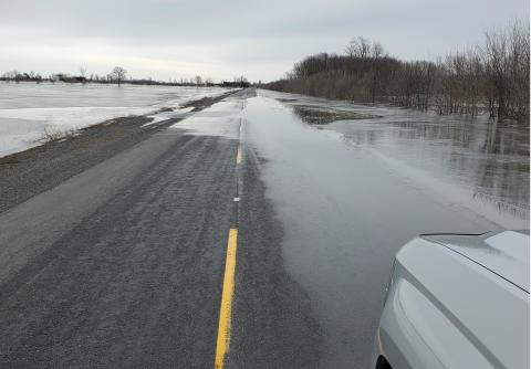
Although water levels across the RRCA jurisdiction remain elevated, they are still within the normal range for this time of year. Fast flowing water and unstable banks may continue to pose hazardous conditions near waterways throughout the region.
Rain ifell on Thursday, April 16, and is forecast again Saturday night, April 18, with a total accumulation of approximately 20 to 35 mm by the end of the weekend. This may result in short term increases in water levels; however, widespread river flooding is not anticipated.
In North Glengarry: The RRCA is actively monitoring and managing lake levels at Loch Garry, Middle Lake, and Mill Pond to reduce the potential for flooding. Water levels in the Garry River, downstream of these lakes, may rise suddenly as part of necessary water level management.
This statement remains in effect until Wednesday, April 22, 2026, at 4 p.m. The RRCA will continue monitoring water levels and weather forecasts as part of its Flood Forecasting and Warning program. Updates will be provided as conditions change.
About flood forecasting and warning in the RRCA jurisdiction
The Ontario Ministry of Natural Resources (MNR) is responsible for flood related emergencies. Flood forecasting and warning has been delegated to conservation authorities. If a local emergency is declared, MNR will work directly with the municipality in consultation with the conservation authority.